YOUR PHOTOS: Severe weather moves across the Commonwealth ⛈️
Don’t know how to use Pin It? Scroll down!
Alli Graham, Digital Content Producer
(AP Photo/Mary Schwalm) (Mary Schwalm, Copyright 2021 The Associated Press. All rights reserved.)
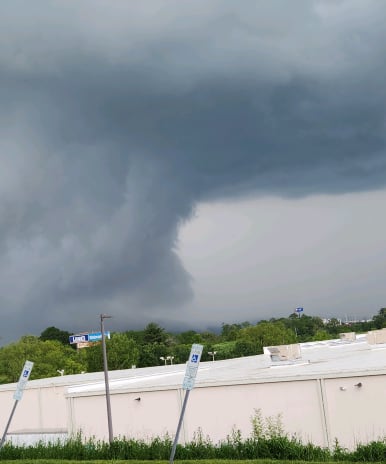
A high-intensity weather day for most of us across southwest Virginia. The potent storm system - combined with warmth and humidity - resulted in severe weather Tuesday afternoon and evening.
Your Local Weather Authority was closely watching storms between 1 p.m. and 9 p.m. Tuesday that were expected to localized wind damage, hail, and flooding. We even had a few tornado warnings pop up throughout the evening.
Recommended Videos
If you snapped any photos of storms or storm damage with us, be sure to share them with us via Pin It.
After you click submit, your photo will appear in our weather gallery here and below. Our team monitors this page regularly for Picture of the Day photos!